

Wirte Walking Tour


Interactive elevation profile
Create PDF
Tour-Details
Starting place: 4642 Sattledt
Destination: 4642 Sattledt
duration: 2h 54m
length: 11,6 km
Altitude difference (uphill): 70m
Altitude difference (downhill): 62m
Lowest point: 373m
Highest point: 421m
difficulty: easy
condition: easy
panoramic view: Some Views
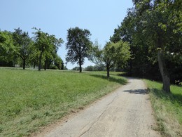
Paths covering:
Asphalt, Hiking trail
powered by TOURDATA
")
")

")


")
Most economical season
- Spring
- Summer
- Autumn
Please get in touch for more information.
4642 Sattledt
Phone +43 7247 67722 - 22
E-Mail info@wels.at
Web www.wels.at
http://www.wels.at
Interactive elevation profile
Create PDF
Tour-Details
Starting place: 4642 Sattledt
Destination: 4642 Sattledt
duration: 2h 54m
length: 11,6 km
Altitude difference (uphill): 70m
Altitude difference (downhill): 62m
Lowest point: 373m
Highest point: 421m
difficulty: easy
condition: easy
panoramic view: Some Views
Paths covering:
Asphalt, Hiking trail
powered by TOURDATA