© Foto: Diesenreiter Wolfgang: Stift Kremsmünster Panorama
Panoramaansicht Stift Kremsmünster
Search
Search
Close

Durch die Tourismusregion Wels - Wels bis Kremsmünster

 Interactive elevation profile

Download GPS data
Create PDF

Tour-Details

Starting place: 4600 Wels
Destination: 4600 Wels

duration: 2h 15m
length: 47,4 km
Altitude difference (uphill): 366m
Altitude difference (downhill): 371m

Lowest point: 294m
Highest point: 438m
difficulty: easy
condition: easy
panoramic view: Great panorama

Paths covering:
Street

powered by TOURDATA

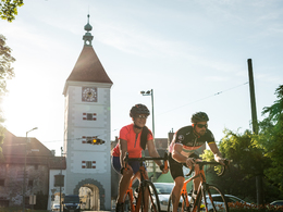
Embedded in the meadows, forests and hills of the Alpine foothills lies the tourist region of Wels with the city of Wels and the municipalities of Sattledt and Kremsmünster, which is made into a road bike paradise by numerous well-constructed side roads with little traffic.
This leisurely beginners' tour runs through the most beautiful parts of the region, starting in Wels and continuing to Kremsmünster, which offers a cultural addition to the sporting programme with its striking Benedictine abbey.


Would you like to use your mobile phone as a sat nav? The tours are available in the Komoot app (free download for Android and iPhone in the store). Alternatively, you can either download the tours as GPX files and call them up on your own GPS device, or import them via the GPX Viewer app and navigate on your mobile phone.
Travelling by public transport
Route planner for independent travellers
Most economical season
  • Spring
  • Summer
  • Autumn

Please get in touch for more information.


Durch die Tourismusregion Wels - Wels bis Kremsmünster
Tourismusverband Region Wels
Stadtplatz 44
4600 Wels

Phone +43 7242 67722 - 22
E-Mail info@wels.at
Web wels.at/rennrad
https://wels.at/rennrad

We speak the following languages

German

 Interactive elevation profile

Download GPS data
Create PDF

Tour-Details

Starting place: 4600 Wels
Destination: 4600 Wels

duration: 2h 15m
length: 47,4 km
Altitude difference (uphill): 366m
Altitude difference (downhill): 371m

Lowest point: 294m
Highest point: 438m
difficulty: easy
condition: easy
panoramic view: Great panorama

Paths covering:
Street

powered by TOURDATA