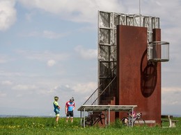
© Foto: Wels Marketing und Touristik: Burggarten Wels
Der Burggarten in Wels lädt zu einen Selfie ein
Accommodation Booking
Arrival
Departure:
<zurückVor>
Mai 2025
MoDiMiDoFrSaSo
   1234
567891011
12131415161718
19202122232425
262728293031 
<zurückVor>
Juni 2025
MoDiMiDoFrSaSo
      1
2345678
9101112131415
16171819202122
23242526272829
30      
search
Search
Close

355 Cycle tour "Weitblick"

  • Suitable for families
  • culinary interesting
  • Flatly

 Interactive elevation profile

Download GPS data
Create PDF

Tour-Details

Path number: 355
Starting place: 4540 Bad Hall
Destination: 4540 Bad Hall

duration: 2h 30m
length: 26,0 km
Altitude difference (uphill): 290m

difficulty: easy
condition: medium
panoramic view: Great panorama

Paths covering:
Asphalt

powered by TOURDATA

Fitness circuit - panoramic view

At 488 metres, the Gustermairberg is the highest elevation in the municipality of Kremsmünster - that's exactly where we want to go and we use an energy-saving route west of Adlwang via Weißenbach for the ascent. The following seven kilometres to our destination for the day are pleasantly flat with a wonderful view of the eastern edge of the Krems Valley.

The "tree in the middle of the world" itself is the crowning glory of the tour and dates back to Emperor Franz the First - the cadastral survey of several crown lands began here in ...

Travelling by public transport
Route planner for independent travellers
  • Suitable for groups
  • Suitable for schools
  • Suitable for teenagers
  • Suitable for seniors
  • Suitable for single travelers
  • Suitable for families
  • Suitable for friends
  • Suitable for couples
Most economical season
  • Spring
  • Summer
  • Autumn

Please get in touch for more information.


355 Cycle tour "Weitblick"
Tourismusverband Bad Hall
Kurpromenade 1
4540 Bad Hall

Phone +43 7258 7200
Fax machine +43 7258 7200 - 20
E-Mail info@badhall.at
Web www.badhall.at
https://www.badhall.at

We speak the following languages

German

 Interactive elevation profile

Download GPS data
Create PDF

Tour-Details

Path number: 355
Starting place: 4540 Bad Hall
Destination: 4540 Bad Hall

duration: 2h 30m
length: 26,0 km
Altitude difference (uphill): 290m

difficulty: easy
condition: medium
panoramic view: Great panorama

Paths covering:
Asphalt

powered by TOURDATA
Protected by