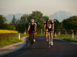
© Foto Oberösterreich Tourismus GmbH/Stefan Mayerhofer: Zuerst muss der Radhelm gut sitzen und dann kann die Rennradtour losgehen.


Auf in die Alpen


Interactive elevation profile
Create PDF
Tour-Details
Starting place: 4600 Wels
Destination: 4600 Wels
duration: 5h 21m
length: 96,4 km
Altitude difference (uphill): 1.113m
Altitude difference (downhill): 1.120m
Lowest point: 312m
Highest point: 728m
difficulty: medium
condition: medium
panoramic view: Dreamtour
Paths covering:
Street
powered by TOURDATA
The tour Wels - Bäckerberg - Franzl im Holz starts in Wels and leads via Schauersberg and Steinhaus through the Upper Austrian Alpine foothills to Eberstalzell. You cycle on to Vorchdorf past Eggenberg Castle, along the Inner Laudach to Radhaming. The tour continues towards Heitzing, Hagenmühle and Wahl over the 717 m high Bäckerberg to Scharnstein. You can expect a winding route with several places to stop for refreshments and beautiful views of the market town of Scharnstein. From Scharnstein, the route runs via St. Konrad to Gasthaus Franzl im Holz in Gmunden, where you can fortify yourself for ...

")


")

Most economical season
- Spring
- Summer
- Autumn
Please get in touch for more information.
Stadtplatz 44
4600 Wels
Phone +43 7242 67722 - 22
E-Mail office@wels.at
Web wels.at/rennrad
https://wels.at/rennrad
Interactive elevation profile
Create PDF
Tour-Details
Starting place: 4600 Wels
Destination: 4600 Wels
duration: 5h 21m
length: 96,4 km
Altitude difference (uphill): 1.113m
Altitude difference (downhill): 1.120m
Lowest point: 312m
Highest point: 728m
difficulty: medium
condition: medium
panoramic view: Dreamtour
Paths covering:
Street
powered by TOURDATA