© Foto: Wels Marketing und Touristik: Burggarten Wels
Der Burggarten in Wels lädt zu einen Selfie ein
Search
Search
Close

Raiffeisen Walking Trail

 Interactive elevation profile

Download GPS data
Create PDF

Tour-Details

Starting place: 4642 Sattledt
Destination: 4642 Sattledt

duration: 1h 57m
length: 8,0 km
Altitude difference (uphill): 26m
Altitude difference (downhill): 20m

Lowest point: 387m
Highest point: 410m
difficulty: easy
condition: easy
panoramic view: Some Views

Paths covering:
Asphalt, Gravel, Hiking trail

powered by TOURDATA

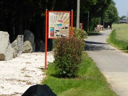
The Raiffeisen walking tour a leisurely route. The 8.5-kilometer long route takes around 2 hours at a leisurely pace. The route can also be used for cycling and walking.
Travelling by public transport
Route planner for independent travellers
Most economical season
  • Spring
  • Summer
  • Autumn
  • Early winter

Please get in touch for more information.


Raiffeisen Walking Trail
Tourismusregion Wels
4642 Sattledt

Phone +43 7242 67722 - 22
E-Mail info@wels.at
Web www.wels.at
http://www.wels.at

We speak the following languages

German

 Interactive elevation profile

Download GPS data
Create PDF

Tour-Details

Starting place: 4642 Sattledt
Destination: 4642 Sattledt

duration: 1h 57m
length: 8,0 km
Altitude difference (uphill): 26m
Altitude difference (downhill): 20m

Lowest point: 387m
Highest point: 410m
difficulty: easy
condition: easy
panoramic view: Some Views

Paths covering:
Asphalt, Gravel, Hiking trail

powered by TOURDATA