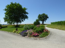
© Foto: Wels Marketing und Touristik: Burggarten Wels
Der Burggarten in Wels lädt zu einen Selfie ein
Search
Search
Close

JMI Walking Trail

 Interactive elevation profile

Download GPS data
Create PDF

Tour-Details

Starting place: 4642 Sattledt
Destination: 4642 Sattledt

duration: 2h 9m
length: 8,5 km
Altitude difference (uphill): 51m
Altitude difference (downhill): 52m

Lowest point: 391m
Highest point: 421m
difficulty: medium
condition: easy
panoramic view: Some Views

Paths covering:
Asphalt, Gravel, Hiking trail

powered by TOURDATA

Walking tour on asphalt, gravel and natural soil
Info stand, P.Engelbertstraße - subway on the right - left towards the veterinary clinic - right towards Gärtnerei Brons - towards Landzeit - right at Frigologo - cross Steinerkirchnerstraße at BAuernhof Dirndlbaumer - straight on at Bauernhof Leithenmair - Goldstr0e - through the forest to the Fronius crossing - cross the B138 - right and along the railway tracks - cross the tracks - Gasthof Bäck im Holz on the left and return to the starting point

Prepared by Gisdat.

 Interactive elevation profile

Download GPS data
Create PDF

Tour-Details

Starting place: 4642 Sattledt
Destination: 4642 Sattledt

duration: 2h 9m
length: 8,5 km
Altitude difference (uphill): 51m
Altitude difference (downhill): 52m

Lowest point: 391m
Highest point: 421m
difficulty: medium
condition: easy
panoramic view: Some Views

Paths covering:
Asphalt, Gravel, Hiking trail

powered by TOURDATA