

After-Work - Viewing hills to the west Wels
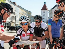


- Suitable for families
- culinary interesting
- culturally interesting
Interactive elevation profile
Create PDF
Tour-Details
Path number: RR03
Starting place: 4600 Wels
Destination: 4600 Wels
duration: 2h 24m
length: 52,9 km
Altitude difference (uphill): 355m
Altitude difference (downhill): 356m
Lowest point: 313m
Highest point: 472m
difficulty: easy
condition: easy
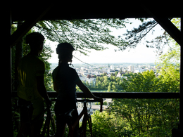
panoramic view: Great panorama
Paths covering:
Asphalt
powered by TOURDATA
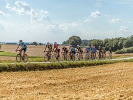
This is a crisp after-work tour, perfectly suited for the day of your arrival. The short route serves up three ascents and splendid panoramic views of the Alps. From ISOLA BELLA, it follows the Traun upstream on side roads to Gunskirchen and Pennewang. In Offenhausen, there are the two viewpoints, Rosenberg and Langholz, with an outstanding panoramic view. Afterwards, the route returns to Wels across the hilly terrain.

")

- Suitable for groups
- Suitable for single travelers
- Suitable for friends
- Suitable for couples
- Spring
- Summer
- Autumn
Please get in touch for more information.
Stadtplatz 44
4600 Wels
Phone +43 7242 67722 - 22
E-Mail info@wels.at
Web www.wels.at/rennrad
http://www.wels.at/rennrad
Interactive elevation profile
Create PDF
Tour-Details
Path number: RR03
Starting place: 4600 Wels
Destination: 4600 Wels
duration: 2h 24m
length: 52,9 km
Altitude difference (uphill): 355m
Altitude difference (downhill): 356m
Lowest point: 313m
Highest point: 472m
difficulty: easy
condition: easy
panoramic view: Great panorama
Paths covering:
Asphalt
powered by TOURDATA